Velek Hacks
Marble Navigator presents aviation weather data in a clear and simple way. No ads or logins necessary. The data is retrieved from a US weather service web site.
While this is a great aid, be careful that the coordinates loaded from the Internet are sometimes off by some distance.
This new release has an identical interface between iPhones/iPads and Android devices. Apple allows sharing configuration data between the application on different iOS devices using their cloud store. Android only allows internal configuration storage in this release.
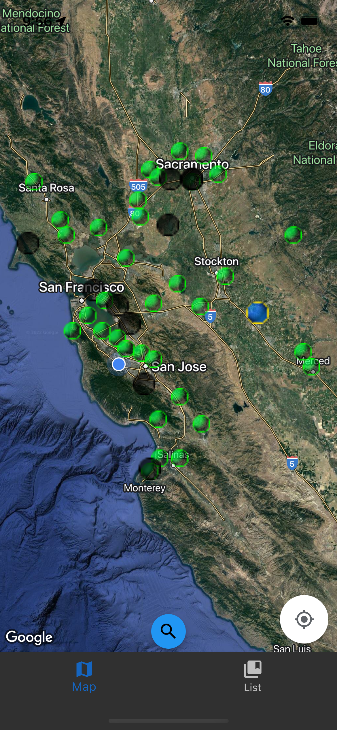
The first view when the application starts up is a Google Map view.
If the device has a built in Barometer, in the upper left hand corner, the Barometric pressure sensor reading will be displayed. Every five seconds it will alternate to the standard altitude calculated for its Barometer reading using the formulas 29.92inHg-(sensor reading) times 1,000'.
The map view will have icons for the device's GPS location, the loaded weather stations, and yellow flags for waypoints the user has added.
For stations which provide METAR weather information it will display different color icons. Green for VFR (Visual Flight Rules), Blue for MVFR (Marginal Visual Flight Rules), and red for IFR (Instrument Flight Rules).
.
At the bottom of the application is a navigation bar, which allows switching to a list view.
If the user does a long press in the map view, it will bring up a window with the coordinates of the location on the map. At the top of this page, it will show the distance to the device's GPS location. There's a drop down menu so kilometers, nautical miles, or statute miles can be selected. It will also calculate them and sbow them in the menu. It also shows local time, the time zone, and Sunset/Sunrise and Civil Day using the system time. Below this a button to load the nearest stations within 100 nautical miles. The list view on this page shows loaded stations and waypoints ordered by distance from this point.
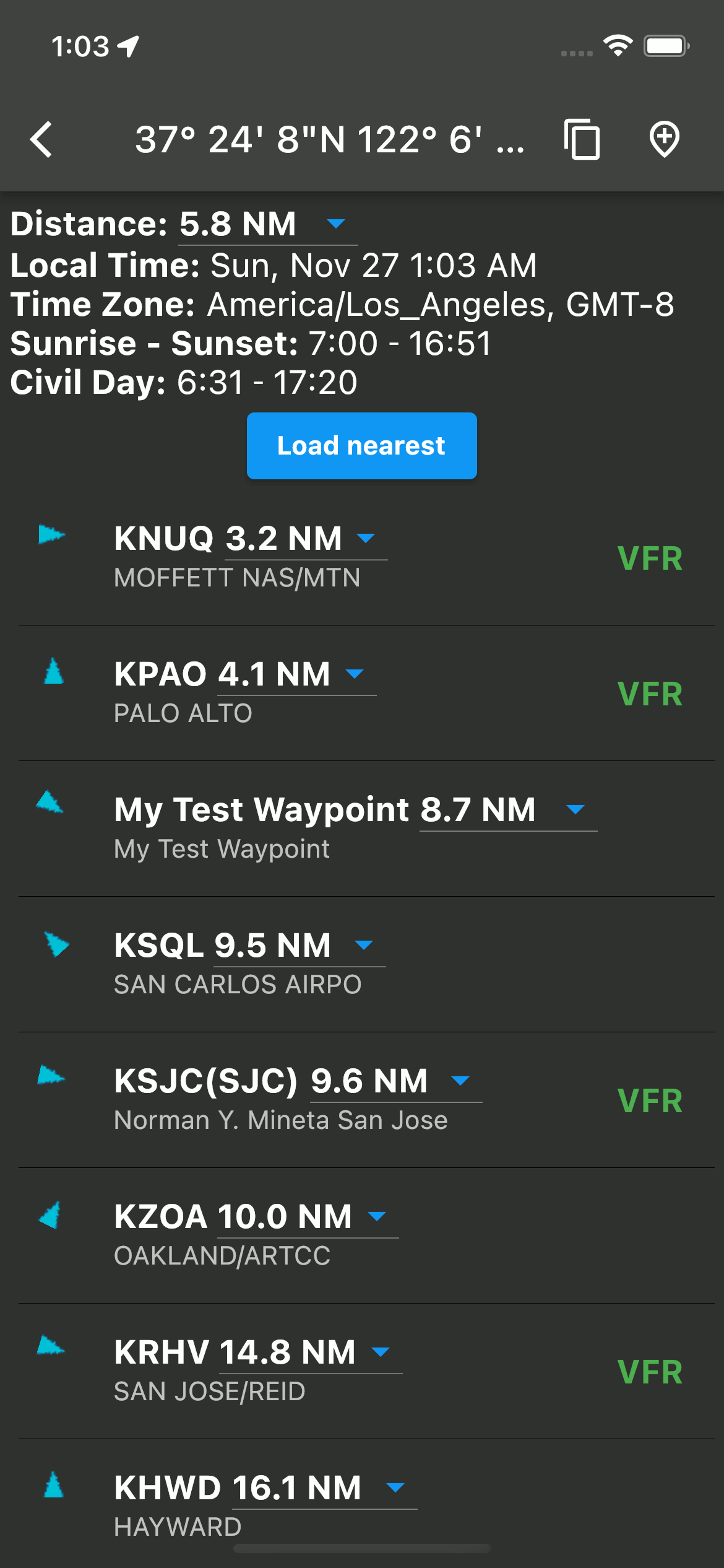
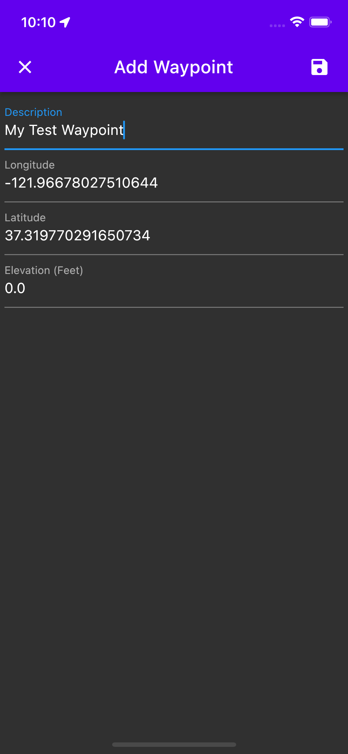
An icon is available at the top of the dialog which will allow the user to add a waypoint.
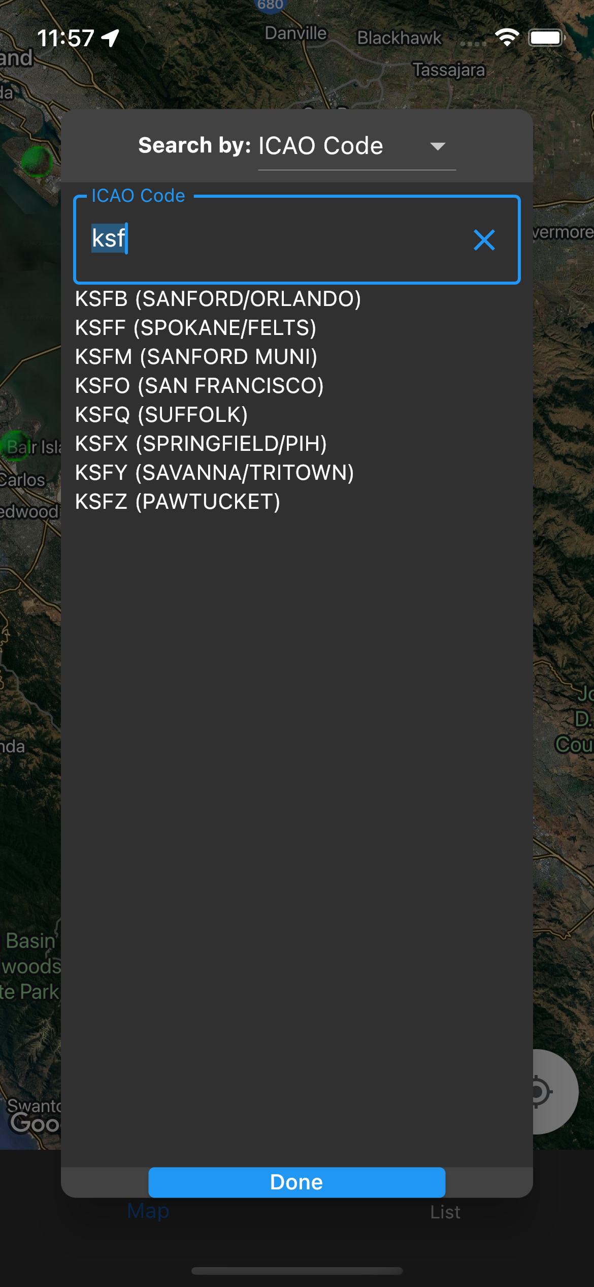
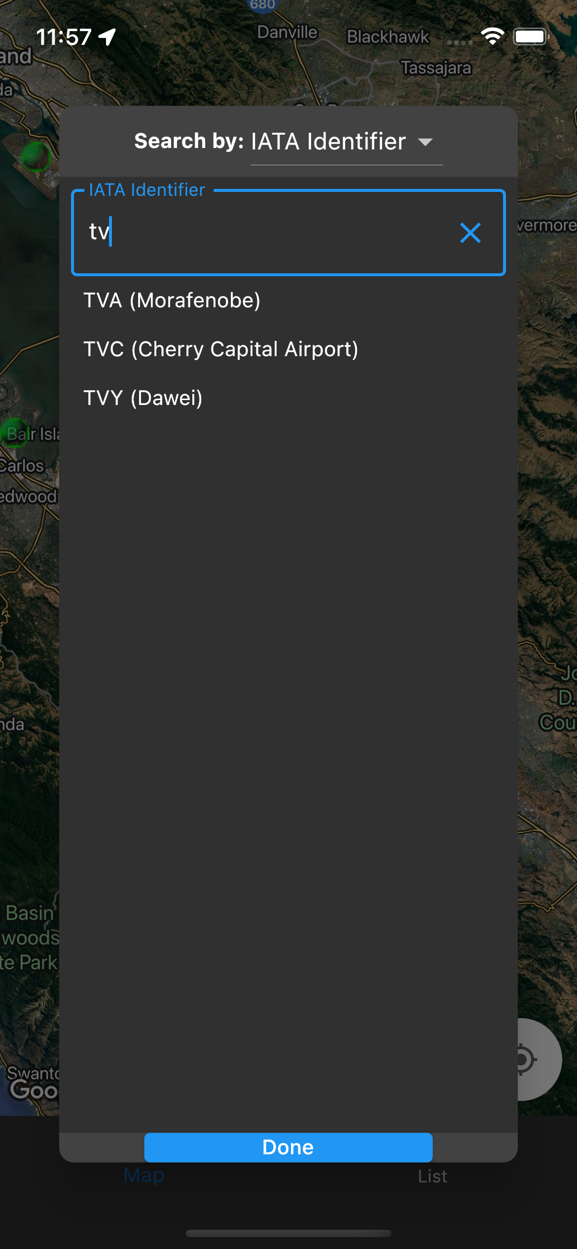
In the bottom center of the map view is a search button that allows searching for stations by ICAO codes or IATA identifiers. If a station is selected, the map location will be moved to center its coordinates.
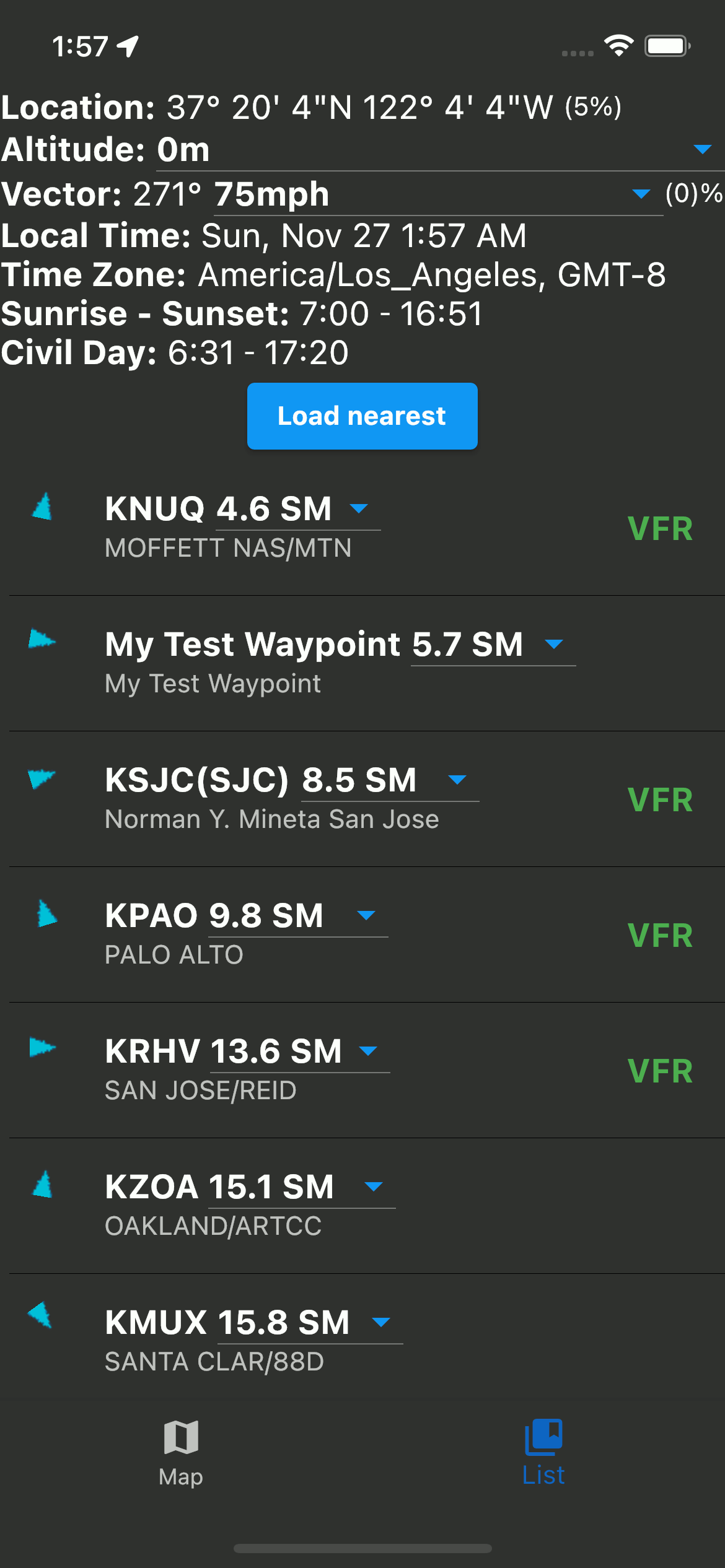
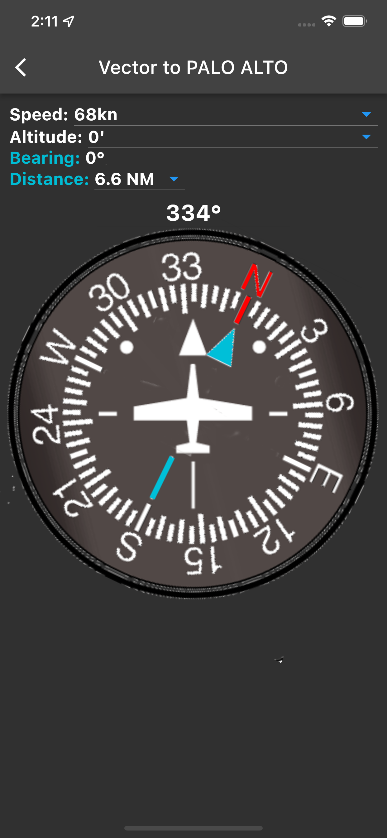
At the top of the list view is some information specific to the device's location using GPS. The GPS coordinates, the current altitude, and a vector, with inertial direction and speed. The altitude is 0 because the app is running in Apple's simulator.
This application will show the current time, date, time zone, Sunrise/Sunset and Civil day using the coordinates provided by the device's GPS and the system time.
The "Load Nearest" button will find the nearest weather stations within 100 Nautical Miles, and load METAR weather data for them if Internet is available. Any bookmarked stations will be loaded on restart if the device is connected to the Internet. Waypoints will be displayed with or without Internet. If GPS is locked, stations and waypoints will be ordered by distance. An arrow will show the direction as well. If not, they will be ordered alphabetically.
As shown in the animation, the Altitude display has a dropdown, showing the altitude in meters and feet. Changing the unit will change the altitude unit for the whole application. The distance also has a dropdown menu.
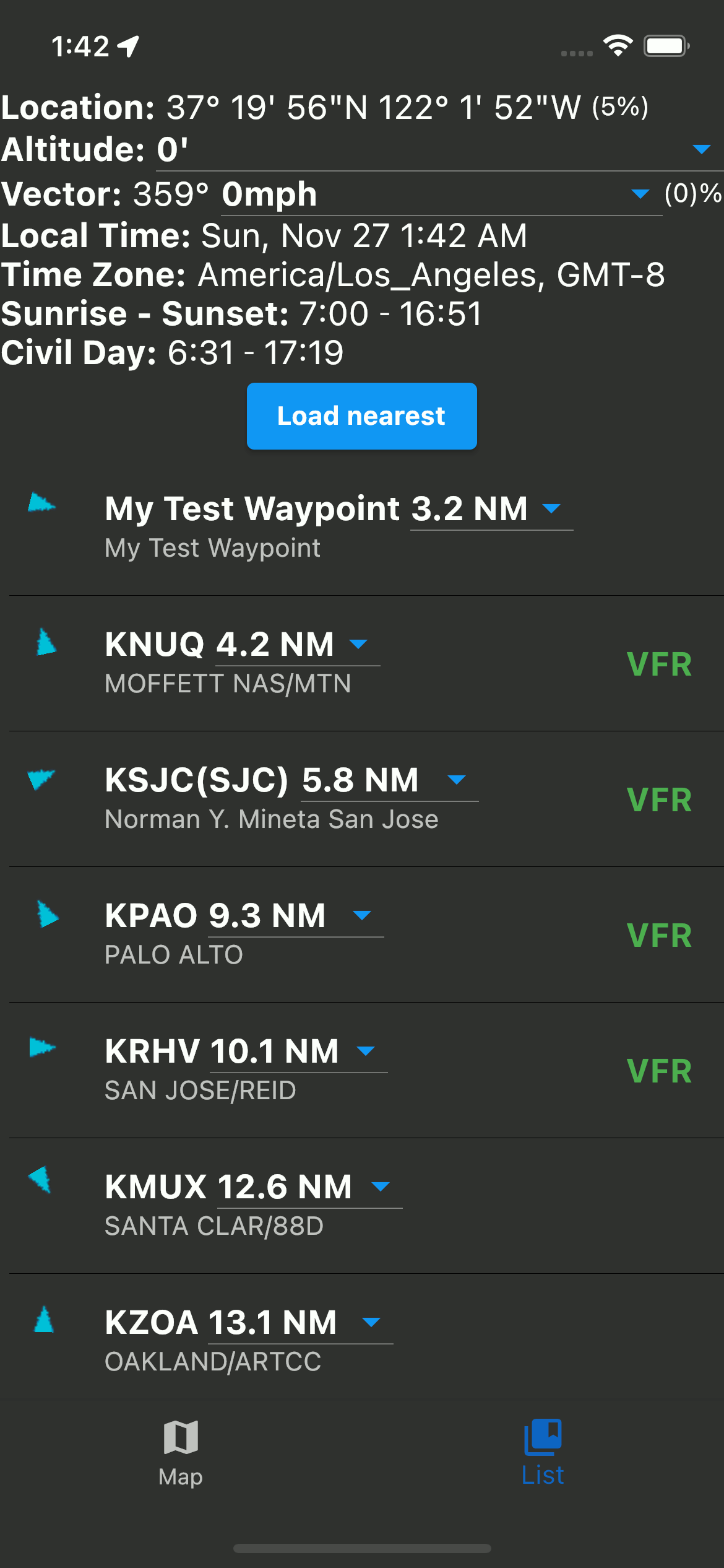
The speed unit can be changed with a dropdown menu, between kilometers per hour, miles per hour, and knots. Opening the dropdown will show all three simultaneously. Changing the unit will change the default speed display unit for the whole application.
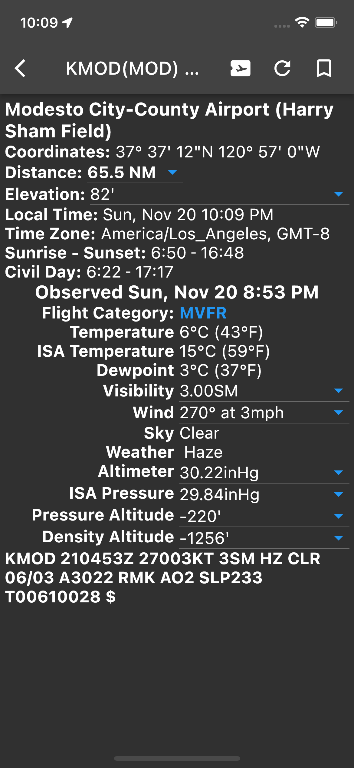
Tapping on a station in the list view will bring up a detail view. In the title bar there are three icons. The left most button, an airplane ticket, will bring up the vector view. The middle button will try to refresh the METAR if Internet access is available. As a rule, METARs are updated in the last five minutes of every hour. The right most button will bookmark or unbookmark the station. If a station is bookmarked the app will try to reload it on successive runs. The station's local time is displayed, and that the times for the current conditions (METAR) are in your phone's current time zone. Also, Sunset/Sunrise and Civil Twilight are calculated using formulas from NOAA. If the station has METARs available the Marble will load them from the Internet. All of the fields are decoded into a user friendly display and the raw METAR is displayed at the bottom. The units are modifiable from drop downs and saved in the preferences. The drop downs calculate the different possibilities for the different measurements.
If the airplane ticket icon is selected in the top bar of a detail view, a page will open up showing a compass. The blue arrow represents the bearing to the selected station.

The name "Velek Hacks" came from a bicycle trip I did across Eurasia. It took three months to cross Russia. Velek comes from a Russian colloquialism for bicycle.

I started writing these apps when I was working on becoming a helicopter pilot, and became a US licensed helicopter pilot in July 2021.